Guest Post by John Williams (at right)
Bull of the Woods and Opal Creek share a boundary, so I thought they would make a good start. Battle Ax Mountain is the highest point in Bull of the Woods Wilderness at 5,566 feet. The trail to the top of Battle Ax Mountain is  straightforward once you reach Beachie Saddle look to your right and follow the trail to the top. Driving into Elk Lake Campground I was surprised to see so many cars. The road in is incredibly rocky and riddled with large holes. A truck or high clearance car is suggested. I made the mistake of driving to the start of the hike where Forest Road 4697 turns into a trail. Parking is no longer allowed here, so save your time and tires; park near the campground. There is a longer (15.5 miles) loop option that will take you to past Twin Lakes and back to the Elk Lake Campground. Despite the fairly large number of people camping at Elk Lake, I only came across two people on the trail. Awesome, friendly people often make hikes around Oregon an even better experience.
 straightforward once you reach Beachie Saddle look to your right and follow the trail to the top. Driving into Elk Lake Campground I was surprised to see so many cars. The road in is incredibly rocky and riddled with large holes. A truck or high clearance car is suggested. I made the mistake of driving to the start of the hike where Forest Road 4697 turns into a trail. Parking is no longer allowed here, so save your time and tires; park near the campground. There is a longer (15.5 miles) loop option that will take you to past Twin Lakes and back to the Elk Lake Campground. Despite the fairly large number of people camping at Elk Lake, I only came across two people on the trail. Awesome, friendly people often make hikes around Oregon an even better experience.
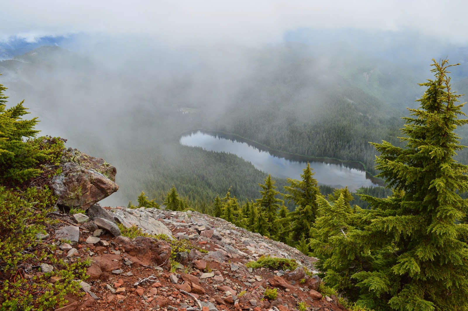
Nearing the top I discovered that clouds had set in around the eastern side of the mountain. This made Elk Lake (photo above by John Williams) look pretty incredible, but obstructed views of the high cascades. After talking for awhile a top Battle Ax Mountain we parted ways. The people from Portland made their way around the rest of the loop and I set out for Beachie Mountain. There are over 75 miles of trails to explore in Bull of the Woods. Whether you're out for a day hike or setting out for a few days Battle Ax Mountain is a great jumping off point into a lush and beautiful area.
Directions from Detroit: Turn left onto Forest Road 46, follow for 4.5 miles, turn left onto FR 4696, follow for .7 miles, turn left onto FR 4697, follow for 9.5 miles. Parking is on the right just before the campground.
Hike Distance: 4.38 from the start of the trail miles round trip
Hike Type: Out and Back
Elevation Gain: 1500 Feet
Trailhead Elevation: 4000 Feet
Usage: Moderate
Difficulty: 3 out of 5
Fees: 5 dollar day pass or Northwest Forest Pass
For more pictures and a map of the area please visit John's blog here and please stay tuned for more hikes from John and others.