

by Gabriel Scott
Cascadia’s forests have a mystic aspect. All the things you know, or think that you know, about the forest are nothing as compared with the layers and layers of wonders to be discovered.
Sometimes you’ll be hiking along, thinking about one thing, and then— wham!— the landscape hits in some unexpected way and everything shifts. Like the world gets suddenly somehow bigger and richer. That was my experience field-checking what we’re starting to call the “Eye of God” unit, one of several atrocities in the BLM’s latest Umpqua Sweets timber sale.
We’d gotten an anonymous tip about an exceptional feature in one small corner unit of the BLM’s Umpqua Sweets sale that we ought to see. I heard it was a difficult spot to get to, so waited to be joined by other WildCATs before striking out into the back woods.
The landscape on the upper part of this sale, up the drainages off the North Umpqua east of Glide, is steep, rocky and unstable. Ancient volcanic activity, heavy rain, and dynamic forests play a role in all kinds of fascinating, beautiful, and unexpected landforms.
Route of proposed new road construction.
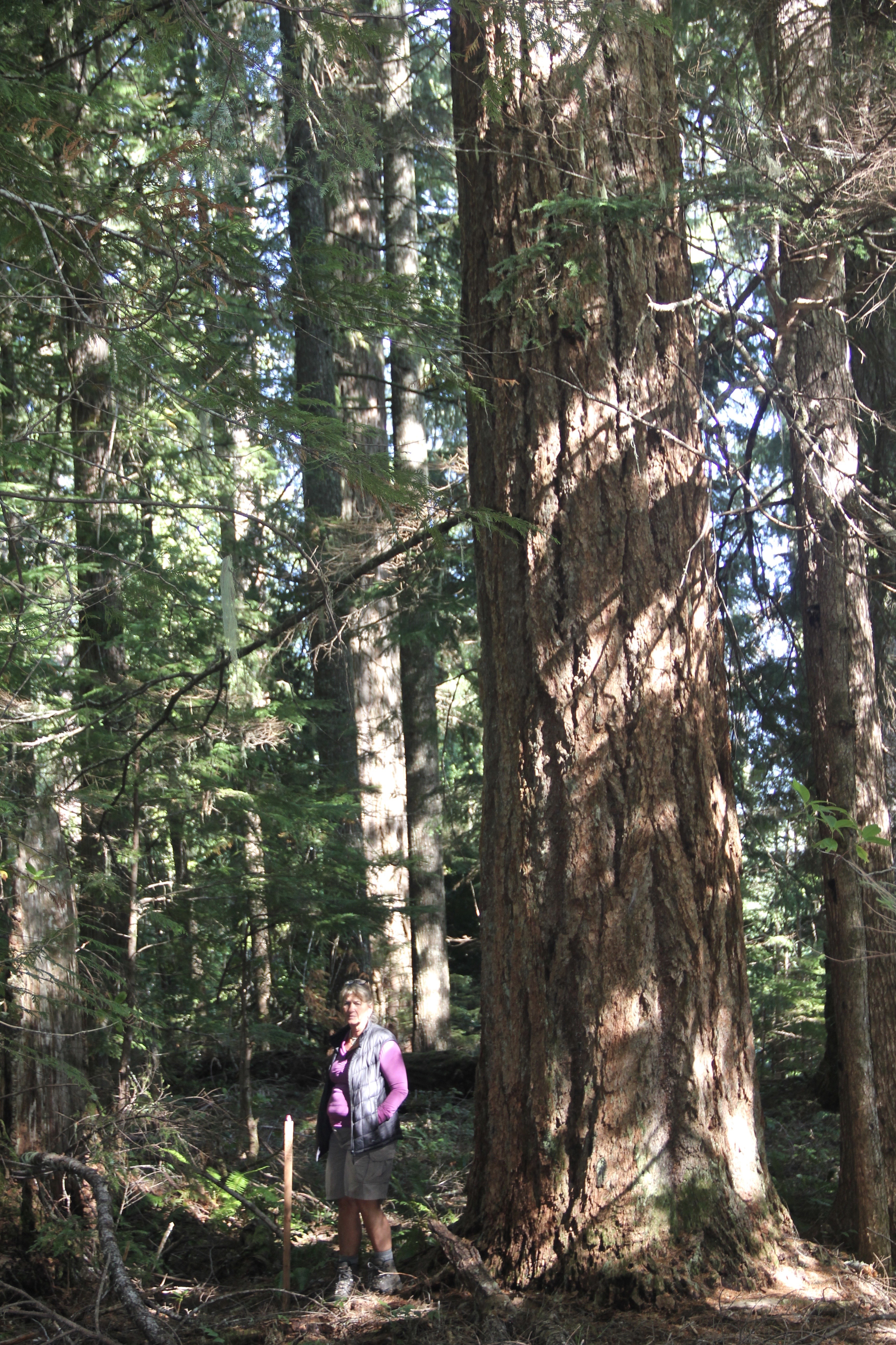
To access the unit we walked up the route of the proposed road construction. Following stakes and flagging, we grew more and more upset to find the road routed through a gorgeous grove of five-foot diameter old-growth. Our skepticism turned to anger on discovering other old spur roads through old clearcuts going to the same location. Is this really necessary?
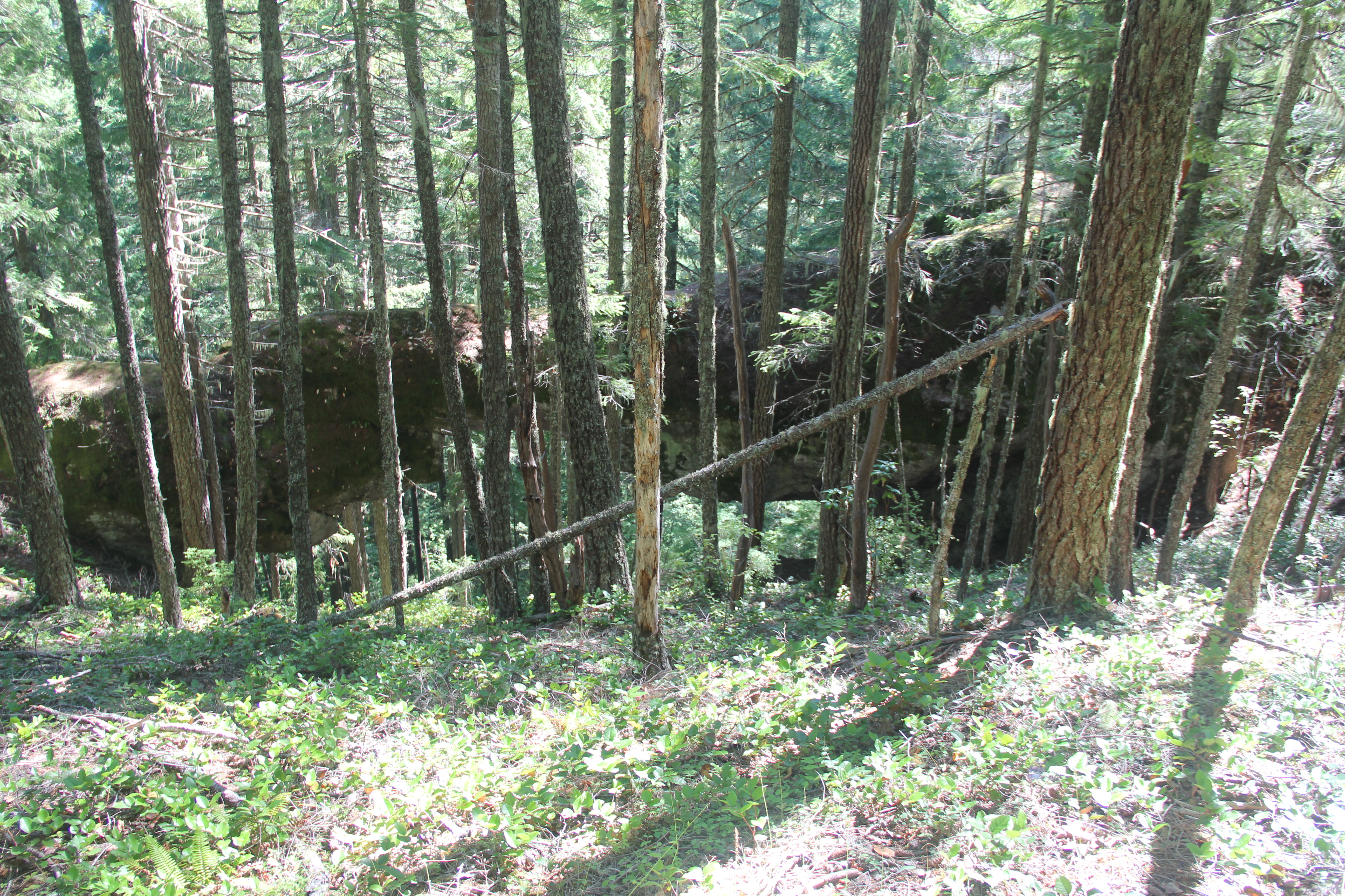
We struggled to follow the stakes and flagging as the the terrain got steeper. Stopped by a jumble of moss-covered boulders, we scrambled straight up the rock, ending at a sort of clearing atop a bluff.
Sheer cliffs dropped off, offering amazing sun-drenched views.
From the top of the bluff we were able to make our way down towards what looked like a less-preciptous bench.
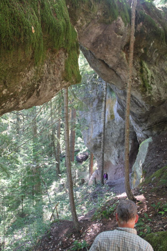
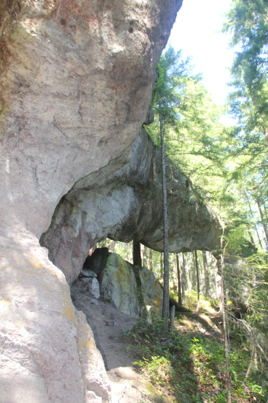
Then, there on our right, through thick trees, barely visible beneath sweeping moss and trees, right at the top of a proposed clearcut, appeared an… opening, an arch of sorts, rising out of the earth.
The strange formation emerges gradually from the thick forest.
A rock archway, covered in moss and fern like a jungle ruin, rose inexplicably from the ground. Peering through it —through the land, through the eye of the earth— we could see the canopy of the green forest beyond.
It looked to me like the top of an eyelid rising from the earth, looking down on the green forest below.
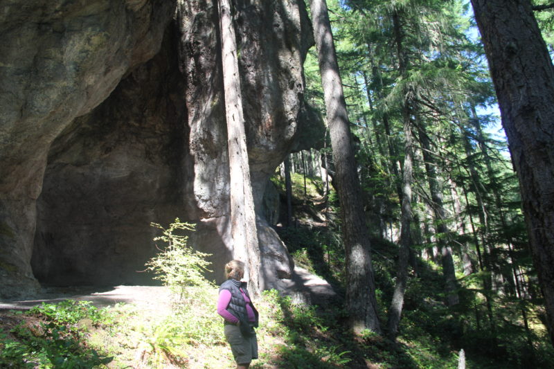
Walking through the arch.
Going closer, the full size and magnificence of the arch became more clear. These photos can’t do it justice. Thick forest and steep ground make any full view impossible. It’s a place that can’t really be captured in an image. You have to experience it.
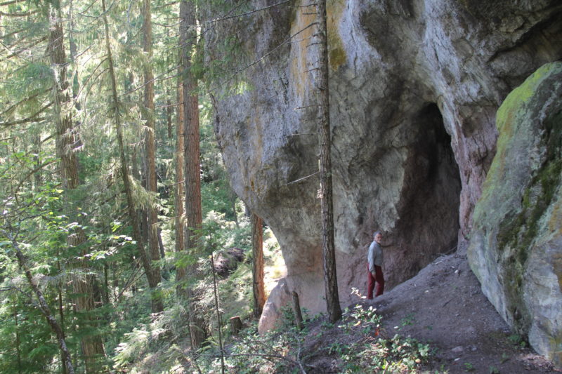
Through the archway.
The arch is nested in the center of the headwaters of a natural drainage. It is as though, here, this is where the flow begins.
Oh, the inadequacy of the modern perspective!
The logging unit follows a perfect square dictated by the checkerboard township and range pattern of ownership. That square happens to overlap with the arch headwaters drainage, also capturing a ridge on one side with another sheer cliff dropping off. We scratched our heads, guessing how loggers would make their way in their tree-cutting robots through the boulders and cliffs.
That blank stone eyelid sees more, and more accurately.
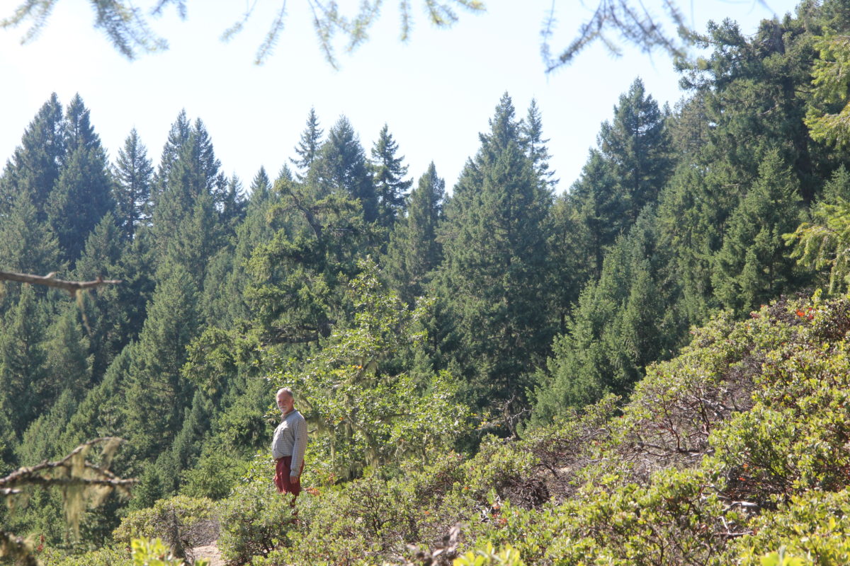
From up on the rock ridges in the unit one looks down and out through the forest canopy.
King Timber
That care-less-ness is not an accident. The irrational and oddly counterproductive approach is demanded by the timber industry. The industry position, aggressively pursued by their lawyers in court cases, is that the land is “timber-dominant.” They take the position that no other interests or user groups can interfere with that pre-eminent objective.
The way BLM is operating under their new plan is cynically mechanical. The Umpqua Sweets project, which would log all sorts of special places without considering any of it significant, is a good example of their approach. The map says harvest land base; therefore, if that place comes to attention, the only possible decision is to regeneration harvest it.
The maps only show logging units, land ownership, logging roads and major drainages, all on the township & range grid system. Things like the massively popular Swiftwater pullout, immediately upstream and on the haul route for the proposed riverside logging, are invisible. Houses, whole neighborhoods, aren’t seen. Smaller streams don’t exist, except incidentally where they can be noticed changing timber designations with riparian reserves.
It is a cold, robotic, uncaring view of the land.
The logging units in Umpqua Sweets were not created by human hands. Literally. They were spit out by a computer given crude instructions for finding available targets for logging.
“Mystic archway” is not an entry on that spreadsheet. Things like this don’t exist.
We are going to have to speak up to keep these natural wonders from being erased.